Full disclaimer — I am not a professional cyclist. I just enjoy going on short cycling adventures with my friends once in a while. But with so many park connectors and cycling trails in Singapore now, it’s time to curate a list of some of the most iconic routes.
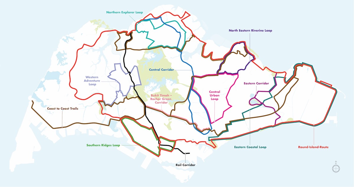
And thanks to NParks, we have a map of some of the most connected trails, which are linked by multiple park connectors. Obviously, this is not an exhaustive list of cycling routes, but I would say that being able to conquer all of them is an achievement. Keep reading and see if you have explored any of them before!
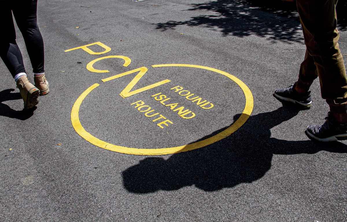
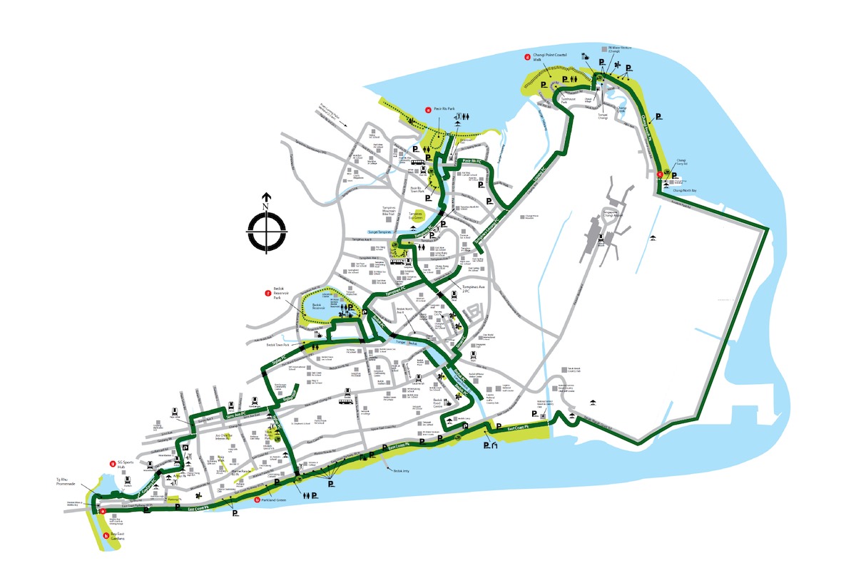
1. Round Island Route — Eastern Half
Route: Rowers’ Bay → Sengkang Riverside Park → Pasir Ris Park → Changi Beach Park → East Coast Park → Gardens by the Bay → Berlayer Creek
Distance: 75km
The Round Island Route (RIR), when completed, will be a continuous 150km park connector that you can cycle on. This will make it the longest recreational cycling trail in Singapore. Currently, Phase 1 of the RIR has been completed and is a 75km route that covers the eastern half of the country.
It “officially” starts from Rower’s Bay and ends at Berlayer Creek, passing through Sengkang Riverside Park, Changi Beach Park and Marina Bay; but you can hop on the trail from any of the key points along the way. For the full map and trail, refer here.
2. Coast-to-Coast Trail (Central)
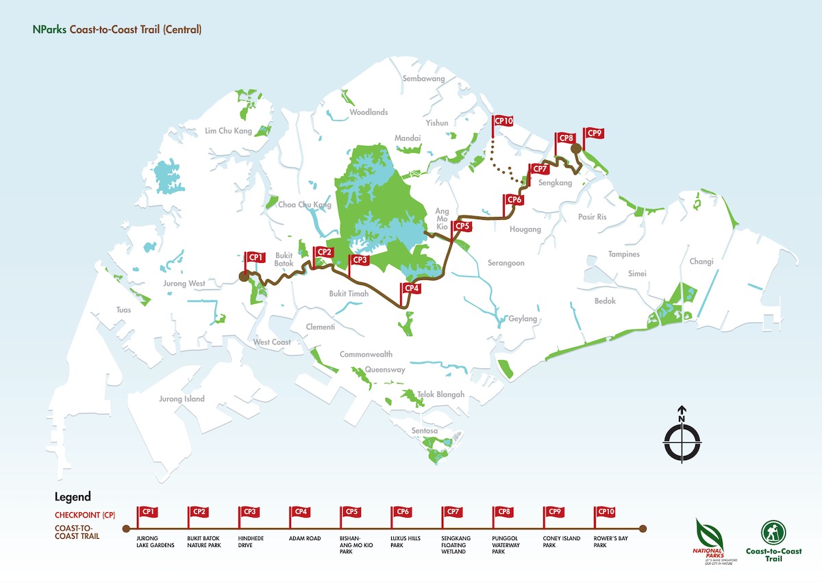
Route: Jurong Lake Gardens → Bukit Batok Nature Park → Bishan-Ang Mo Kio Park → Sengkang Floating Wetland → Coney Island Park → Rower’s Bay Park
Distance: 36km
The Coast-to-Coast (C2C) Trail (Central) is a 36km trail that goes from the west of Singapore to the north-east. It connects nature areas and parks, making it great for walking too. Cycling will definitely cover the distance in a shorter time, while still allowing you to appreciate the lush greenery along the way.
This route starts from Jurong Lake Gardens and ends at Rower’s Bay Park, passing through the Bukit Batok Nature Park, Bishan-Ang Mo Kio Park and Coney Island Park. For a full guide to the C2C Trail, refer here.
3. Western Adventure Loop

Route: Choa Chu Kang Park → Bukit Panjang Park Connector → Dairy Farm Nature Park → Bukit Batok Nature Park
Distance: 20km
For all the westies, you can explore the Western Adventure Loop, a slightly shorter 20km trail that is still packed with many things to see and do. Iconic areas you will pass by are Little Guilin at Bukit Batok Town Park, Dairy Farm Nature Park and Bukit Timah Nature Reserve.
If you are up for a challenge, you can even try mountain biking up the slopes of Bukit Timah Nature Reserve. But if you’re going for a chill ride, take in your surroundings, which inlcude beautiful lakes and natural species such as birds, insects and plants. For a complete guide to the Western Adventure Loop, click here.
4. Northern Explorer Loop

Route: Admiralty Park → Woodlands Waterfront → Central Catchment Park Connector → Lower Seletar Reservoir Park → Sembawang Park
Distance: 25km
Heading over to the north, there is the Northern Explorer Loop, which is nearest to residents living in Yishun, Sembawang and Woodlands. The 25km trail passes through 11 parks and nature areas, starting from Admiralty Park and ending at Sembawang Park. On the way, cyclists will pass by Woodlands Waterfront, Woodlands Town Garden, Central Catchment Nature Reserve and Yishun Park.
Keep your eyes peeled along the way and look out for colourful bird species like the Crimson Sunbird, and heritage trees like the Ordeal Tree. For a brochure containing more information about the Northern Explorer Loop, click here.
5. Rail Corridor
Route: Kranji Node → Mandai Park Connector → Bukit Timah Truss Bridge → Bukit Timah Railway Station → one-north Park → Spooner Road → Tanjong Pagar Railway Station
Distance: 24km
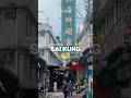
This one’s a little bit more exotic. The Rail Corridor is a 24km continuous green passage that stretches from Kranji all the way down to Tanjong Pagar Railway Station. There are multiple access points into this recreational path, but cyclists are advised to keep to a 10km/hr speed limit for safety. This is perfect for those of us who like slow rides.
As the name of the route suggests, it is famous for passing through locations like the Bukit Timah Railway Station and Tanjong Pagar Railway Station, though the latter is currently undergoing restoration works.
Do note that only certain parts of the Rail Corridor are lit up at night, so night cycling is not recommended here. For more information, visit the website.
6. Central Urban Loop
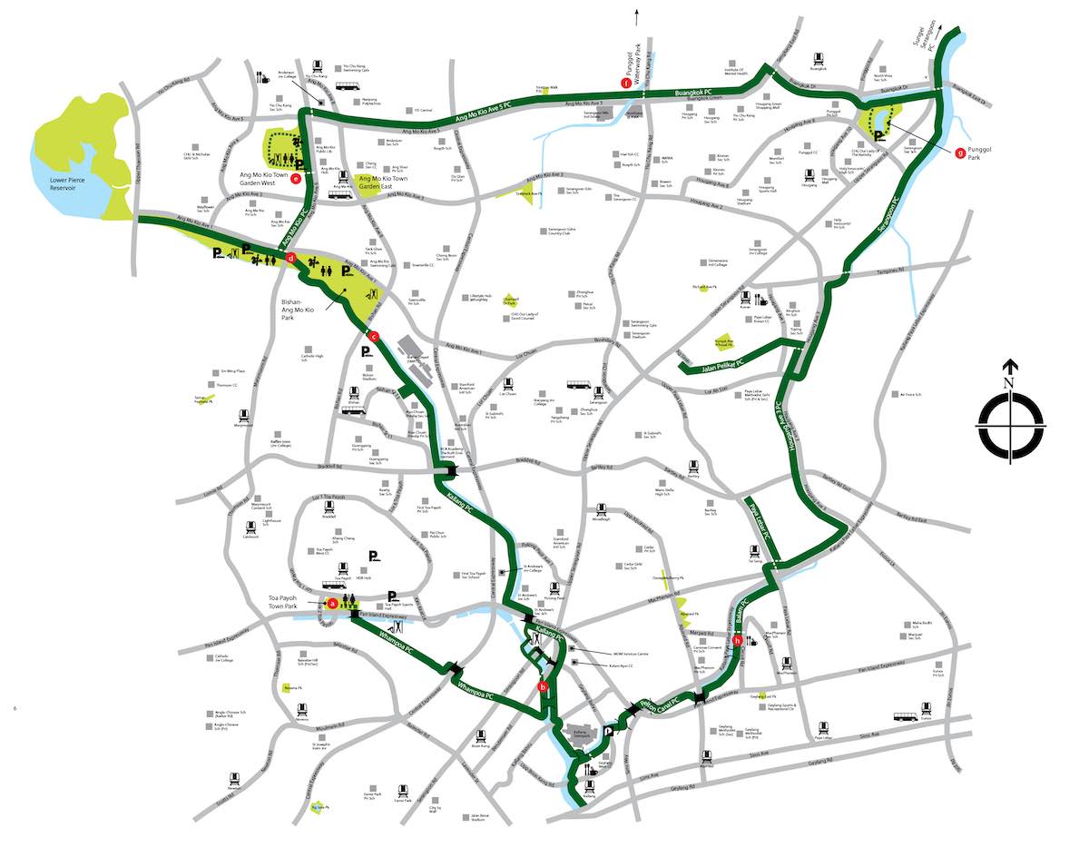
Route: Toa Payoh Town Park → Kallang Park Connector → Bishan-Ang Mo Kio Park → Punggol Waterway Park → Pelton Canal Park Connector
Distance: 36km
If you’re more of an urbanite like me, this trail will suit you well. The Central Urban Loop cuts across HDB estates in Bishan, Toa Payoh and Whampoa. Cycling along this 36km route will allow you to experience the charm of heartland areas in central Singapore while having easy access to amenities and hawker options nearby.
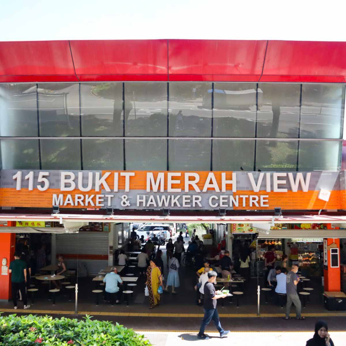
11 pit stops to recharge along the Round Island Route’s (RIR) eastern half
The Central Urban Loop begins at Toa Payoh Town Park and ends back at Pelton Canal Park Connector. It makes its way through Kallang Park Connector, Bishan-Ang Mo Kio Park and Punggol Waterway Park. If you’re a fan of lakes and rivers, you will enjoy this trail. Just watch out for traffic along the way.
Find out more here.
7. North Eastern Riverine Loop
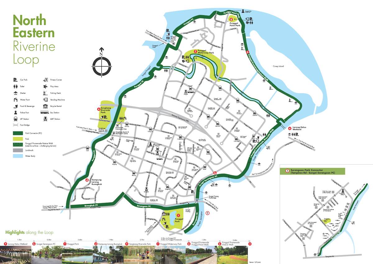
Route: Lorong Halus Wetland → Punggol Park → Kampung Lorong Buangkok → Sengkang Riverside Park → Punggol Promenade Nature Walk
Distance: 26km
The North Eastern Riverine Loop is another route that cuts through heartland areas, this time in the north-east region of Singapore. If you like urban environments, but also want to experience more rustic landscapes and waterways, this will be perfect for you.
Starting at Lorong Halus Wetland and ending at Punggol Promenade Nature Walk, this 26km trail will give you scenic coastline views and bird-watching opportunities.
For more details, click here.
8. Eastern Coastal Loop
Route: East Coast Park → Changi Beach Park → Pasir Ris Park → Bedok Reservoir Park → Singapore Sports Hub → Bay East Gardens
Distance: Approximately 50km
When it comes to cycling, how can we forget East Coast Park, right? The Eastern Coastal Loop is probably one of the more popular cycling routes in Singapore, starting from East Coast Park and making a giant loop back to Bay East Gardens.
On the way, you will pass by Changi Beach Park, Pasir Ris Park, Bedok Reservoir and the Singapore Sports Hub. There are a number of eating places along the way, so you can make multiple pit stops if needed.
9. Eastern Corridor
Route: Pasir Ris Park → Tampines Eco Green → Bedok Reservoir Park → East Coast Park
Distance: 18km
If you are looking for a shorter route but still want to explore the east of Singapore, consider the Eastern Corridor. At just 18km, this trail can be completed relatively easily and quickly, especially by cycling. It starts from Pasir Ris Park, and then cuts through Tampines Boulevard Park and Bedok Reservoir Park, before ending at East Coast Park.
For residents who live in the area, this is a great excuse to visit East Coast Park while getting some exercise done at the same time. For more details on the Eastern Corridor, refer here.
10. Marina-to-Changi Trail
Route: Marina Bay Sands → Gardens by the Bay → East Coast Park → Changi Beach Park → Changi Jurassic Mile
Distance: 48km
For the last cycling route on this list, I have decided to customise and create one based on my personal cycling experiences. I’m calling it the Marina-to-Changi Trail, and it is a combination of routes I have explored with friends and a recommendation by LTA.
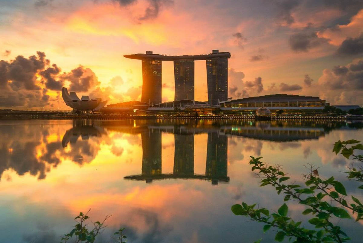
At 48km long, this route can be physically demanding for some, but it will provide interesting sights along the way. From the iconic Marina Bay Sands to the greenery of Gardens by the Bay to the dinosaurs at Changi Jurassic Mile, there is much to see.
There is also a stop at Changi Village Hawker Centre around 3 quarters into the journey, so that you can rest and have a meal before completing the last part of your adventure. Changi Jurassic Mile is also a nice place to end your trip because you can take photos with dinosaurs and visit the nearby airport terminals if you’d like.
For the full cycling route, click here.
Largest Dinosaur exhibition at Science Centre Singapore is here